Eyam Museum
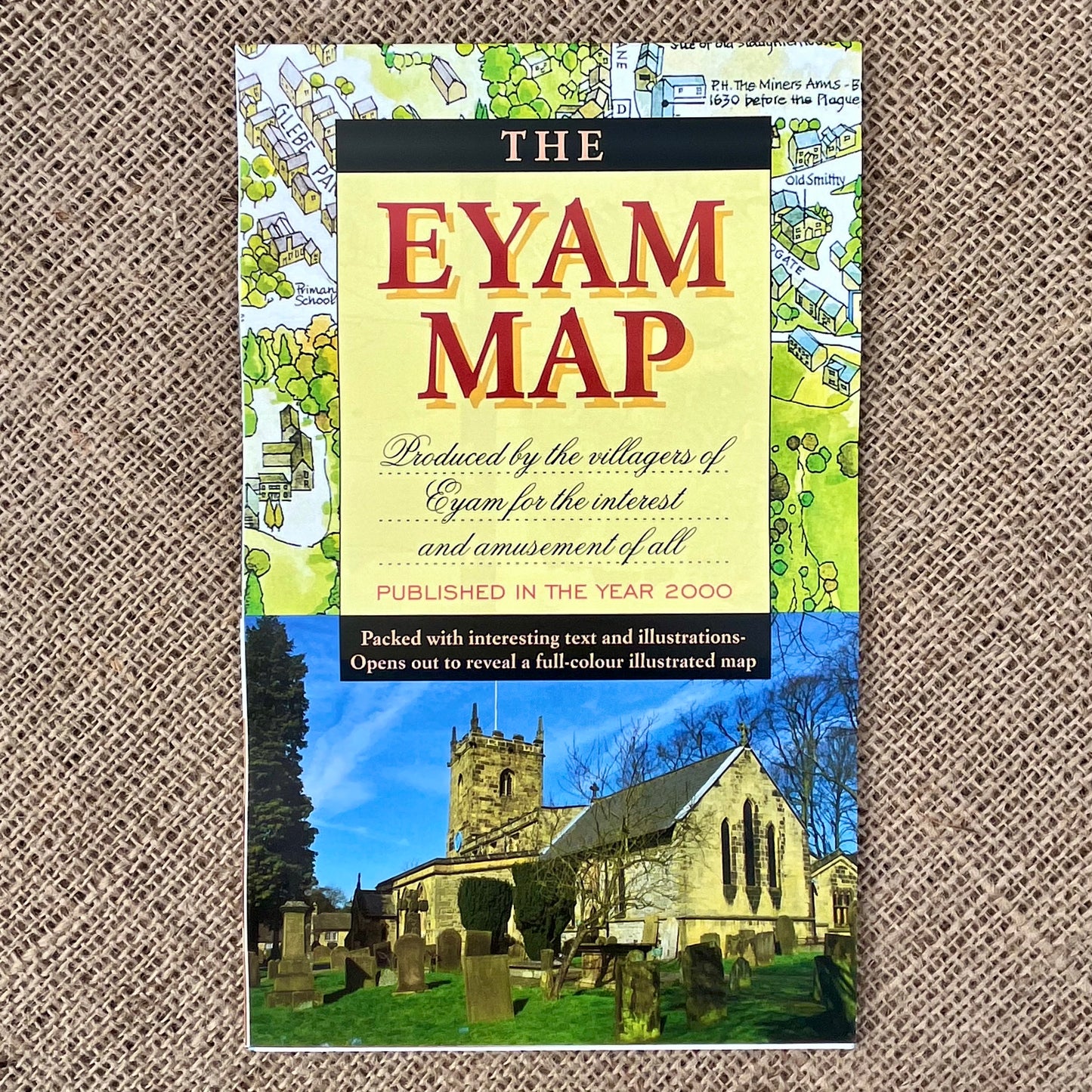
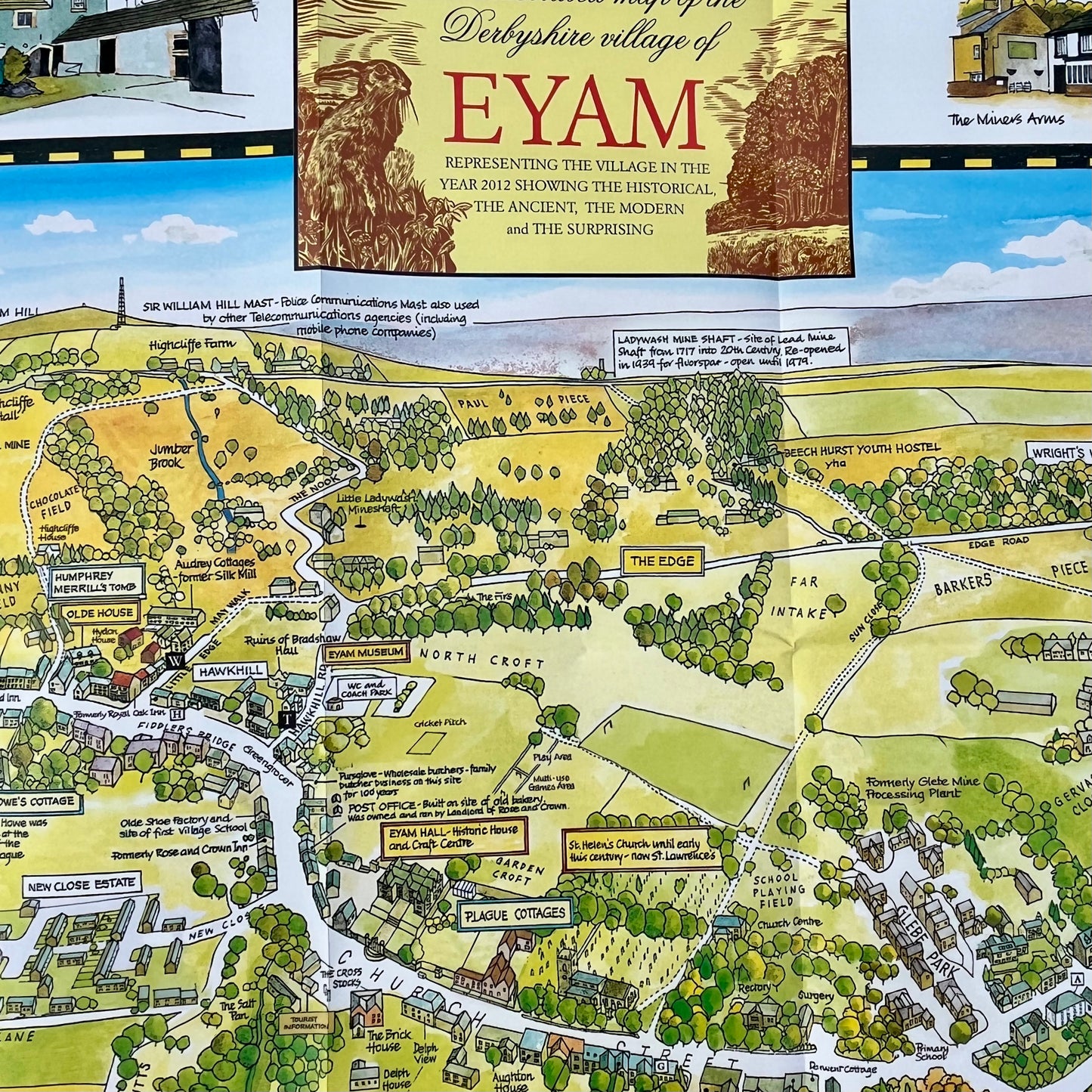
Eyam Illustrated Map
Eyam Illustrated Map
Couldn't load pickup availability
If you are interested in historical, ancient, modern and surprising facts about Eyam then this beautifully illustrated fold-out map is ideal!
Originally published in the year 2000 - as a millennium project - and revised in 2012, this map will show you all the buildings in Eyam and pinpoint key historical sites.
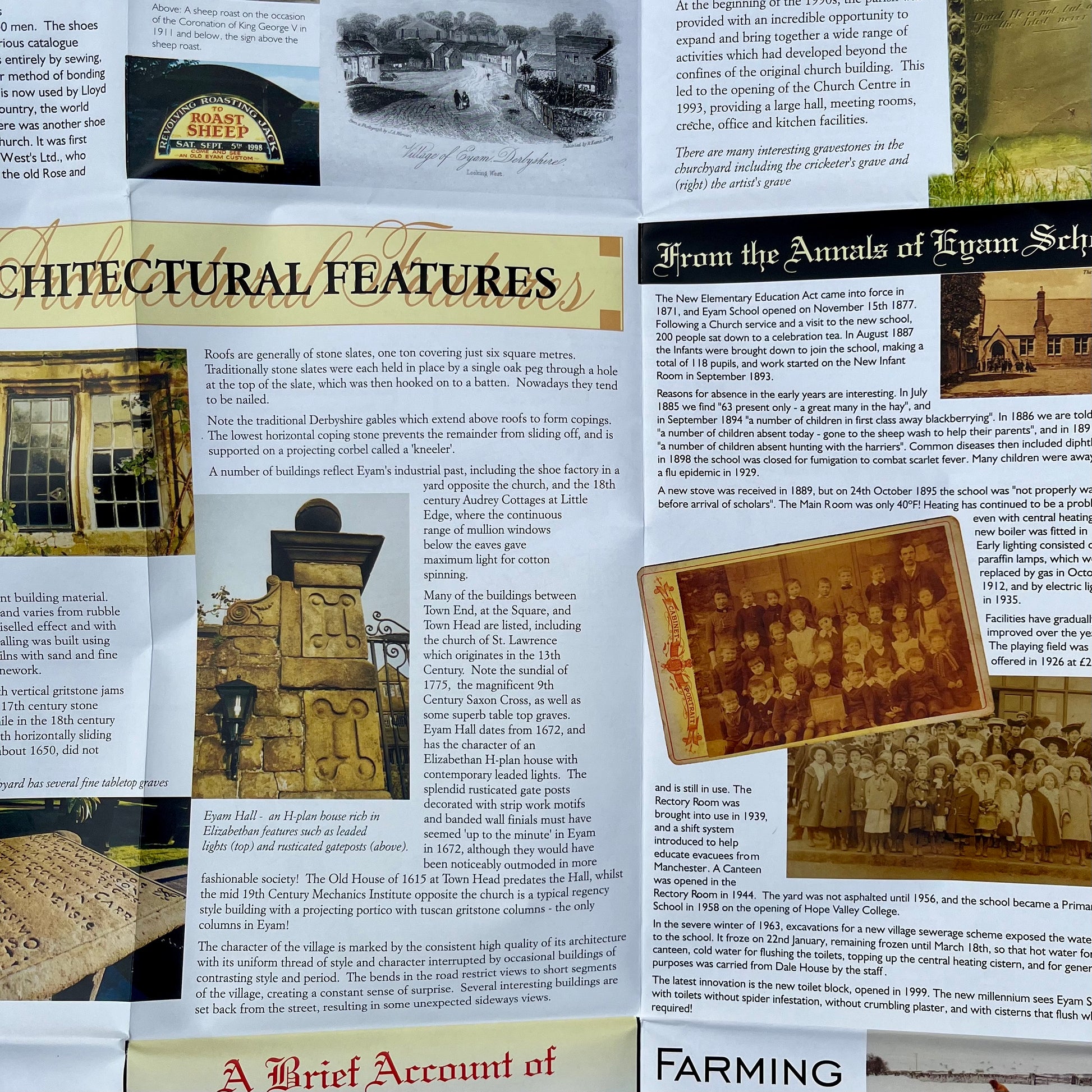
On the reverse you can read memories of an Eyam resident, find out about the village school, parish church (and other buildings), learn about industries such as geology, lead mining, caving and farming and also discover local wildlife.
Useful and beautiful, this could be a great resource for a classroom.
Format: Folded in a clear plastic sleeve
Size folded: W 14 x L 23.
Size unfolded: W 70 x L 100 cm